Large-Scale Mapping in Plains of Nebraska
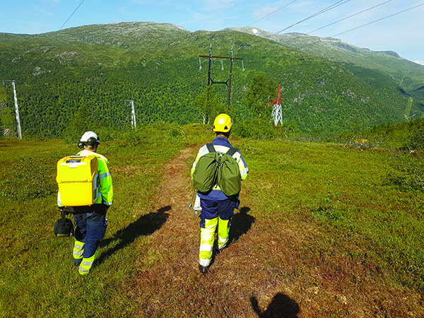
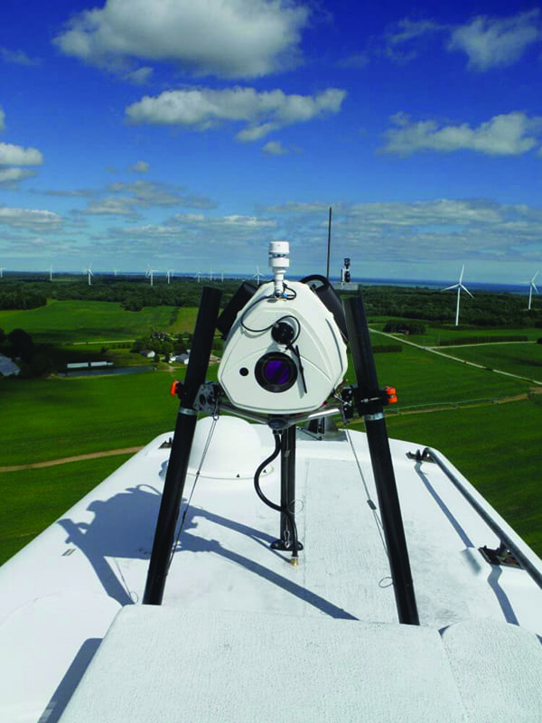
Kevin Kenna has lots of experience with GNSS (Global Navigation Satellite System) and major projects for utilities, government agencies, and large-area mapping. He’s used GPS (Global Positioning System) and GNSS for more than two decades and estimates that he has worked on mapping/surveying more than 20,000 miles of power lines; a project of 10,000 square miles is not unusual for him. Kenna’s current work involves establishing ground control for a series of aerial LiDAR (Light Detection and Ranging) mapping projects in Nebraska. He’s establishing checkpoints that are used to determine and correct any vertical bias in the airborne measurements.
Creating accurate maps over large areas draws on an array of sensing technologies including digital imaging and LiDAR. To ensure accurate geo-referencing of the sensors, Kenna uses GNSS to provide precise positioning data. When working on projects covering large areas, real-time GNSS can be limited, so Kenna’s firm, Denver-based Merrick & Co., switched to RTX (Real Time Extended) technology.
For the most part, the work requires high accuracy in the vertical component—one of the most challenging aspects for GNSS surveyors. And it often takes place in areas where conventional RTK (Real Time Kinematic) is impractical and VRS (Virtual Reference Station) is not available.
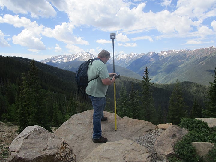
Before putting RTX into practice, the firm conducted extensive tests to confirm that the solution could produce reliable results. They chose Trimble’s CenterPoint RTX correction service to test for accuracy and high productivity (Figure 1).

On a recent project covering 8,000 square miles in northeast Nebraska, Kenna captured roughly 350 points for aerial LiDAR. The contract’s quality control terms required 50% of the points to be measured twice, with the two measurements agreeing to within 5 centimeters (cm) vertically.
Working alone, Kenna completed the field work in roughly three weeks. The work included additional points to improve redundancy in the checkpoints as well as ties into NGS (National Geodetic Survey) control three times in each county, with a minimum of five minutes of data at each occupation.
Kenna used a GNSS receiver with a controller running Access software. The receiver collects the RTX correction data directly from communications satellites and produces real-time positions accurate to 2 cm horizontal and 5 cm vertical. The software monitors each observation and displays information that enables Kenna to assess the accuracy at every point. At the end of each day in the field, he compiled the measurements in Trimble Business Center software and produced results in the coordinate system specified by the client.
Simplified Logistics for Aerial Surveys
Aerial mapping has for years required terrestrial base stations to provide reference points for post-processed kinematic (PPK) measurements to establish ground control points as well as base stations for precise GNSS positioning of the airborne sensors. The approach required base stations to be not more than 20 miles apart. The switch to RTX removed those constraints and provided a significant increase in flexibility. Merrick uses Applanix POS AV systems in its fixed-wing and helicopter surveys, and processes the data in POSPac MMS software and RTX-PP post-processing (Figure 2).
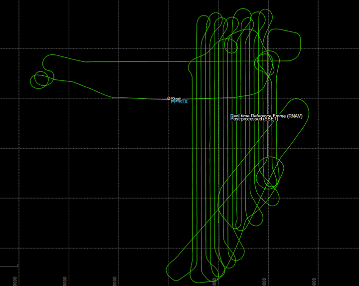
Merrick’s Director of Operations and Technology Matt Bethel sees two improvements resulting from CenterPoint RTX: “Historically, on larger projects we would target what we felt to be the portion of a block with the best flying weather for a given day and set bases up there. If the weather changed and affected visibility from the air, then we would be forced to stop flying for the day. It’s really nice to have the flexibility to move freely around projects without concern about base stations and CORS [Continuously Operating Reference Station] locations. Secondly, the plots show us that the LiDAR data is as good as, or maybe slightly better than, previous methods of single-base GNSS. Therefore, we didn’t sacrifice any accuracy while gaining the ability to move freely around large projects and save time that was historically spent setting up bases.”
RTX also eliminates the need for fixed base stations or ties to terrestrial GNSS networks, which often require access to cellular communications (Figure 3). This gives Bethel and Kenna flexibility in planning and executing their projects while maintaining confidence that their results will meet stringent accuracy requirements.
“Not needing to set up base stations in the morning, and go back and pick up at the end of the day, is a huge advantage from the way it used to be,” Kenna said. “Now, as technology advances, things become more efficient and we get a lot more production.”
—John Stenmark is a writer and consultant working in the geospatial, architecture, engineering, construction, and associated industries.