LIDAR
-
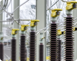 O&M
O&MFrom Static Maps to Smart Systems: How GIS, LiDAR and Geospatial AI are Reshaping Utility Inspections
Visual inspections of the power grid have traditionally relied on manual methods and reactive responses. These inspections, whether performed on foot, by helicopter or drone, often involve fragmented data systems and delayed reporting cycles. The approach worked for decades, but it is no longer sufficient. Utilities are now facing intensified pressure on several fronts. Infrastructure […]
-
 Trends
Meet the Tools Helping Power Companies Separate Threats from Noise
As threats to power companies rise—from cyberattacks to theft and vandalism—many utilities are rethinking how to secure facilities and critical infrastructure. Outdated systems that constantly trigger false alarms from wind, weather, or wildlife are draining resources—making it imperative for utilities to modernize their security to improve response, cut costs and reduce reliance on armed personnel. […]
-
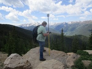 Technology
Increasing Accuracy on Power Line Surveys
Large-Scale Mapping in Plains of Nebraska Kevin Kenna has lots of experience with GNSS (Global Navigation Satellite System) and major projects for utilities, government agencies, and large-area mapping. He’s used GPS (Global Positioning System) and GNSS for more than two decades and estimates that he has worked on mapping/surveying more than 20,000 miles of power […]
-
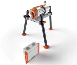 Press Releases
The future of SGRE turbine performance tests offshore and onshore is the ZX TM nacelle Lidar
Siemens Gamesa Renewable Energy (SGRE) statement of testing and approval of nacelle based wind Lidar ‘ZX TM’ from ZX Lidars for the purpose of Power Performance Testing on Siemens Gamesa wind turbines released In connection with a power curve campaign, Siemens Gamesa has tested a new technology together with the well-known company ZX Lidars. Based […]
-
 Technology
Technology in Construction: Matching Solutions to Specific Challenges
This is the last of a three-part series on technology in construction. In the May issue, Part I focused on predicting and adapting to change. Part II—in the July issue—examined choosing and implementing
-
Renewables
Green light for GreenGo Lidars in Italy for wind projects
GreenGo Srl, a wind farm development company founded in 2018, has confirmed that the Remote Sensing Technology Lidar is supporting their development work for new wind farms in Italy. In their first project, GreenGo selected ZX 300 and were supported by Italian company Studio Rinnovabili (also known as SR international) to install the autonomous Lidar […]
-
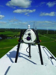 O&M
O&MLiDAR Technology Mated with Wind Energy Quickly Becoming an Industry Standard
The profitability of a wind farm depends directly upon reducing uncertainty when wind resources are being assessed and when wind turbines are being fine-tuned. Project risks vary from site to site, depending
-
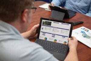
 IIOT Power
Immersive Visual Environments, Advanced Analytics Drive Operational Optimization
As data volume, variety, and velocity continue to accelerate, power plant operators increasingly encounter situations where 2-D desktop data visualization is insufficient to convey context for advanced