AccuWeather’s team of expert meteorologists is warning people and businesses to start preparing for a frenzy of tropical activity that could have major impacts on the U.S. this hurricane season.
“The 2024 Atlantic hurricane season is forecast to feature well above the historical average number of tropical storms, hurricanes, major hurricanes, and direct U.S. impacts,” said AccuWeather Lead Hurricane Forecaster Alex DaSilva. “All indications are pointing toward a very active and potentially explosive Atlantic hurricane season in 2024.”
Factors Behind the Prediction
AccuWeather is calling for up to 25 named storms, with as many as 12 of hurricane strength—up to half of those could directly impact the U.S. DaSilva said there are four driving forces contributing to the forecast for a super-charged hurricane season.
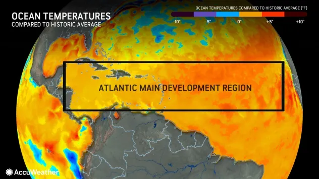
Ocean Temperatures Are Off the Charts
Warm water can act as fuel for tropical systems to rapidly intensify into powerful and destructive hurricanes. “Sea-surface temperatures are well above historical average across much of the Atlantic basin, especially across the Gulf of Mexico, Caribbean, and the Main Development Region [Figure 1],” DaSilva explained. AccuWeather Chief Meteorologist Jon Porter said there is high confidence that sea-surface temperatures across the Atlantic basin will remain well above the historical average throughout the 2024 hurricane season.
Flipping from El Niño to La Niña
A shift underway in the Pacific Ocean could have major implications on tropical activity thousands of miles away over the Atlantic Ocean. Waters near the equator of the eastern Pacific are in the process of changing from an El Niño pattern to a La Niña pattern, which could happen by mid- to late-summer.
During an El Niño pattern, waters in the eastern Pacific are warmer than the historical average. In La Niña, sea-surface temperatures in the eastern Pacific are cooler than the historical average. DaSilva said La Niña often leads to less disruptive winds, known as wind shear, over most of the Atlantic basin. The combination of less wind shear and warmer water provides prime conditions for tropical development.
Weather Patterns in Africa
Meanwhile, the expected transition to La Niña is forecast to promote a stronger African easterly jet stream, which can boost the African monsoon. A stronger African jet stream could support more periods of dry air moving off the continent of Africa, which could hinder tropical development in the early part of the hurricane season. However, AccuWeather expert meteorologists warn that a stronger African jet stream could lead to more robust tropical waves later in the season, resulting in additional opportunities for tropical storms to form.
Changes in Location and Strength of Steering Winds
The strength, orientation, and position of a feature known as the Bermuda-Azores High pressure area can have a major influence on the formation of tropical storms and hurricanes. AccuWeather expert meteorologists say the Bermuda-Azores High can be offset farther south and east compared to the historical average, due to warmer sea-surface temperatures. This placement can favor a period of re-curving tropical systems in the western Atlantic when the high is weaker, and another period of storms reaching the Caribbean and Gulf of Mexico when the high is stronger.
What Utilities Can Do in High-Risk Areas
According to AccuWeather, the Texas coast, Florida panhandle, south Florida, and the Carolinas are all at a higher-than-average risk of direct impacts this season. Power companies serving these regions are no strangers to hurricanes. Many, if not all, of them have well-developed preparation and recovery plans in place, and they regularly update them based on industry best practices and lessons learned from past storms.
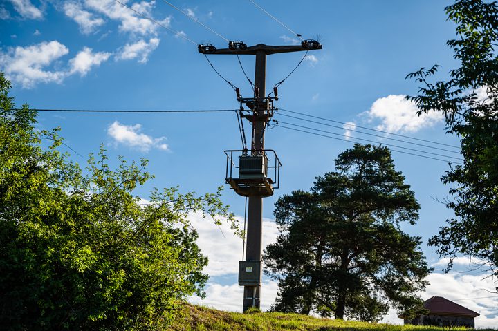
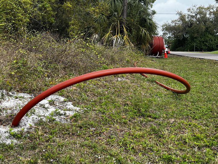
For example, in Florida, following particularly active and intense hurricane seasons in 2004 and 2005, the Public Service Commission adopted extensive storm hardening initiatives. Wooden pole inspection and replacement programs were adopted and vegetative remediation solutions were implemented. Additionally, investor-owned electric utilities were ordered to file updated storm hardening plans for the commission to review every three years. Beyond that, some utilities accelerated efforts to underground power lines in high-risk areas (Figure 2). All of these measures vastly improved grid reliability and resiliency.
Michael Levy, U.S. Networks lead and Global Head of Asset Resilience at Baringa, a global management consulting firm, noted on a recent POWER Podcast episode that Florida Power & Light (FPL) has seen marked improvements in system resilience as a result of its grid hardening efforts. Levy compared the effects FPL experienced from Hurricane Michael in 2018 to those of Hurricane Ian in 2022. “When Ian came, despite being a bigger and stronger hurricane, they had no transmission lines down, which, of course, are very costly and time intensive to replace, and they were able to restore customers three times as fast, despite having more customers out. So, they’re experiencing what we like to call at Baringa ‘the rewards of resilience,’ because investing in resilience is a fraction of restoration costs,” said Levy.
“All residents and interests along the U.S. coast, including Puerto Rico and the Virgin Islands, should have a hurricane plan in place and always be fully prepared for a direct impact,” concluded AccuWeather’s DaSilva.
—Aaron Larson is POWER’s executive editor (@POWERmagazine).