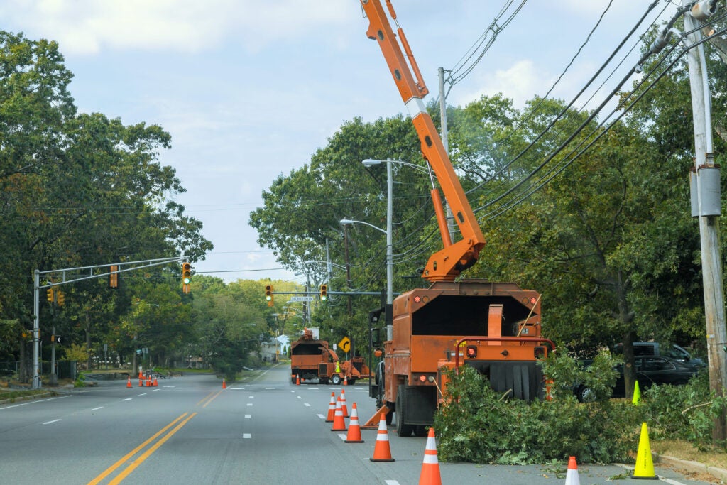
Vegetation is a much-needed part of the natural world and is essential for life to thrive on Earth. Yet, when unmanaged, it’s also one of the greatest threats to the grid and a leading culprit for causing outages. Fallen branches topple powerlines, roots damage underground cables, and overgrown trees close to energized wires are known to ignite catastrophic wildfires.
The consequences are enormous. Power outages hit Americans with a $150-billion bill every year, based on Department of Energy numbers, and vegetation issues are behind a lot of those costs.
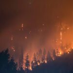
Just two years ago, a devastating wildfire hit Maui, killing 102 people and destroying 2,200 structures. Sparks from damaged utility lines re-energized unexpectedly, setting nearby vegetation on fire. This is a devastating reminder of the difficult balance utilities must strike between keeping the lights on and protecting public safety.
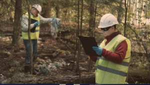
Historically, utilities have used routine trimming and in-person inspections to manage vegetation. But with labor shortages, rising costs, and wildfire risk increasing, they now need to evolve into risk-based vegetation management.
AI alongside drones and LiDAR (light detection and ranging), provide visibility, predictive modeling, and automation. This empowers utilities to reduce risks, cut costs, and maintain compliance, all while mitigating outages and keeping the power on.
The Vegetation Challenge
Vegetation may seem like a simple problem to solve, but in practice it’s one of the most persistent threats to reliable power delivery. Fast-growing species grow towards overhead conductors, and storms, heavy winds and ice cause branches to snap, igniting wildfires, taking down power lines and triggering widespread outages. And the industry has been grappling with this issue for decades. With extreme weather causing more frequent wildfires, the industry must adopt AI to protect the grid and serve its ratepayers.
Yet traditional approaches are not working. Ground crews may spend weeks patrolling remote corridors on foot or by truck, only to cover a fraction of the system. Helicopter inspections expand coverage areas but bring considerable safety concerns and hefty price tags. And more than half of utilities admit their vegetation management funding doesn’t match operational requirements.
The situation, therefore, becomes even more problematic. Vegetation threats are growing while the money to address them keeps shrinking. AI presents an opportunity to bridge this gap.
How LiDAR and AI Can Drive Smarter, Safer Vegetation Strategies
Utilities have long needed to supplement manual inspection with technology like satellite imagery, aerial surveys, and, more recently, drones. Yet the real breakthrough comes when high-resolution LiDAR data is combined with AI, transforming raw images into actionable business insights.
Clarity of Data Collection: LiDAR technology allows utilities to survey vast areas and infrastructure in weeks by creating detailed 3D point clouds capturing vegetation density, tree height, and encroachment risks with centimeter-level accuracy. Manual patrols simply can’t match this. And the data stays objective and repeatable and avoids human error or fatigue. This removes significant pressure from manpower constraints, eliminating the need for crews to spend days on manual inspections.
AI Modeling of Data: AI and ML algorithms review and analyze LiDAR data to detect vegetation encroachment, tree health issues, and potential hazards in high-risk areas. Rotting trees create serious risks for power lines during intense storms and high winds, for instance. Utilities can use LiDAR-based modeling to identify problematic trees, then quickly dispatch teams to safely remove them—this reduces future outage risks.
Via a combination of data from past vegetation growth, weather, and up-to-date field insights, LiDAR and AI-driven modeling, can predict future issues. For example, the AI system flags areas where fast-growing trees will likely extend onto transmission and/or distribution lines, causing outages in future storms. This gives utilities sufficient data and time for proactive tree trimming crew scheduling rather than waiting for outages or fire risks during storms or natural vegetation growth.
Fixed Cycle to Risk-Based Scheduling
Traditionally, utilities trim vegetation on fixed cycles. For instance, trim trees every three or five years, regardless of actual risk. Instead of trimming every mile of line on a fixed schedule, utilities can use AI risk models to target the most vulnerable corridors. With crews attending to the most risk-prone areas first, this supports risk-based scheduling. This targeted approach reduces outage risk, lowers wildfire exposure, and improves compliance with regulatory clearance standards. And as importantly, this approach saves money: avoiding routine trimming where it isn’t needed and reallocating funds to high-risk zones.
Centralizing Data: On top of its exceptional modeling capabilities, when utilities leverage an AI platform, it provides a centralized location for all data. When teams continuously gather information from the field like photos and sensor readings, they can be documented and stored in a centralized system, creating a single source of truth for decision-making, accessible to all. Combining field data collected on a continuous basis with LiDAR data gathered on an annual basis provides a powerful dataset for modeling.
This “single source of truth” creates a living digital twin of the network and enhances audit readiness, regulatory reporting, and cross-department collaboration. Instead of sifting through fragmented spreadsheets and inspection notes, decision-makers see a unified risk picture across the grid.
Implementation Considerations: AI may sound like the magic bullet for utilities in their efforts to get vegetation management under control, but it takes some thoughtful planning to implement AI safely and successfully.
AI Integration: One of the first hurdles utilities face when adopting LiDAR and AI is making it work with their existing utility management systems. Most utilities have a patchwork of tools, including outage management systems, GIS mapping, SCADA monitoring, and asset management platforms that don’t ‘talk’ to each other.
Integrating AI so its recommendations flow directly into existing workflows is a must. AI should be able to automatically create a maintenance ticket, update the asset database, and alert the right teams for follow-up actions when it spots a risky stretch of power lines. All of this must be completed without manual data entry, along with the ability for human intervention.
The way to make this happen is by building a robust data pipeline:
- Bringing in data from LiDAR, drones, satellites, and field crews.
- Cleaning and standardizing that data so it’s usable.
- Storing the data in an organized and consistent way.
- Running AI models to turn raw data into prioritized, actionable insights.
When done right, integration allows AI to become part of the utility’s daily operations, helping crews respond faster and budgets stretch further.
Staff Training and Operational Changes
Even the best AI system won’t make an impact if people don’t know how to use it. Vegetation management crews, dispatchers, and planners need training not just on the software but on how to interpret and trust AI-driven recommendations.
For success, utilities need to appoint change management leaders to organize the training and control the AI rollout. Hands-on training for AI literacy, clear communication about “why” the shift is happening, and a phased adoption so staff don’t feel overwhelmed will all assist in an easier transition. In practice, this looks like an AI pilot program used to prioritize inspections in one region, allowing teams to feel confident and comfortable before scaling company-wide.
Utilities have to stretch tightened budgets to maintain the millions of miles that make up utilities infrastructure across the U.S., but leaning on manual inspection is not feasible or efficient. Integrating LiDAR and AI solutions smartly and safely can help utilities reduce risks, improve compliance, and shift from reactive to proactive vegetation management.
Regulatory and Security Considerations
Utilities face compliance obligations under North American Electric Reliability Corporation (NERC) standards. AI tools can strengthen audit readiness by providing timestamped, geolocated evidence of vegetation clearances.
At the same time, centralizing sensitive data introduces cybersecurity risks. Utilities must ensure robust protections for cloud storage, mobile field devices, and AI platforms.
Financial Justification: Convincing utility executives to invest in AI requires more than technical promise. It requires financial justification. Fortunately, there’s compelling potential for the return on investment.
- UReduced inspection costs: LiDAR and AI analysis can cover in weeks what might take boots-on-the-ground crews months and years.
- Lower outage costs: Preventing even a single wildfire or large-scale outage can save hundreds of millions, even billions in potential liabilities and fines. Utilities have reported a 45% reduction in outages by using LiDAR and AI modeling for vegetation management.
- Improved compliance: Automated reporting reduces manual effort and audit penalties.
- Optimized trimming cycles: Targeted risk-based scheduling saves money by trimming only where needed.
Early adopters have seen inspection cost reductions of 30 to 50%, in addition to saving millions annually in avoided emergency response. As AI models mature and data volumes grow, these savings are likely to accelerate.
Unmanaged vegetation is a persistent and costly challenge for utilities. AI and LiDAR can help utilities shift to a proactive approach to managing vegetation. With a technology-forward approach utilities can manage risk, stretch budgets farther, improve compliance and reliability, and enhance resilience.
—Hari Vasudevan is founder and CEO of KYRO AI.