Location-based information has played an important role in the utility industry for decades, but that history is just a prelude to the dramatically larger role it will play in the industry going forward. Nearly every aspect of how utilities are managed—from plant operations to renewable energy initiatives, from environmental compliance efforts to maintenance programs—will be impacted by the kinds of insights that are now possible from location data. This is a technological inflection point for the industry that will usher in a new era in how utilities use technology.
The scope of this impact, or the “Era of Location Intelligence,” cannot be overstated, and the timing of it could not be better. The operational and business insights gleaned from location data are invaluable for tackling the most complex challenges that utilities face not only today but for the rest of this decade, especially as the industry’s workforce ages and there is an influx of younger tech-savvy employees. These challenges include:
■ Sustainability and net-zero targets.
■ Public safety and emergency response.
■ Regulatory compliance.
■ Industry consolidation.

In This Issue
Full issue■ Accelerating market changes.
 |
|
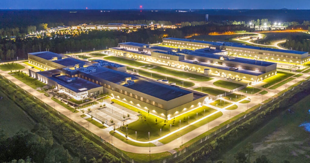
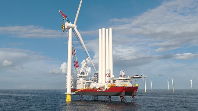
1. The operational and business insights gleaned from location intelligence are indispensable for solving the most complex challenges that utilities are facing, including how electricity is generated and distributed. Courtesy: Locana |
Simply put, utilities cannot solve these challenges without the help of location intelligence (Figure 1). The organizations already taking steps to embrace this new era have positioned themselves for success, and those that are slow to use location intelligence will needlessly struggle to achieve their most ambitious objectives.
To understand the significance of location intelligence, it is important to look at the humble beginnings of location data and technology in the utilities market. The science of location data goes back decades, when digital devices that incorporated location information in their functionality first emerged. Early examples included wired sensors in industrial settings, electronic reports filed by workers, and digital maps for site planning and infrastructure maintenance.
The utilities industry was a natural home for this technology because so many use cases for location technology fit into how utilities generate electricity and deliver power, natural gas, and water. That data and the software used to analyze it were complex, though, so small departments were established in utilities around the globe to do this niche work.
|
Connected Plant Conference Features Digital Technologies Location intelligence, along with many digital initiatives impacting power generation, is among the topics that will be featured at POWER’s Connected Plant Conference, taking place May 23–26 at the Renaissance Waverly Hotel in Atlanta, Georgia. The event includes discussions about digital technology improvements and the growing field of applications that are reshaping the power generation and chemical processing industries. |
Today, every utility has a geospatial team, and those groups face intense demands for collecting and analyzing location data to support operational functions across the organization. The pressures on those departments have grown exponentially because of unprecedented growth in the sheer amount of data, as well as increasing applications of the data (see sidebar).
In fact, location-based information is ubiquitous in utilities today. If your organization is using sensors to monitor power generation machinery, using wireless tablets for workers conducting maintenance checks, or using environmental monitoring equipment to measure emissions, then location data is already a critical part of your operations.
Geospatial Software
While the volume of data and the number of use cases has grown, the size of geospatial departments has remained relatively static. That’s because the complexity of working with geospatial software and related technologies has traditionally required advanced degrees and hard-to-find skillsets. Those kinds of professionals do not grow on trees, which put an artificial limit on the impact of location data and technology. The potential to utilize location for an even greater number of applications within a utility was there, but the talent pipeline served as a gating factor, limiting some of location’s reach.
That was then, but things are very different today thanks to a convergence of factors that are unleashing the potential of location data and technology in the industry. One of the biggest factors is the democratization of software used to turn raw location data into actionable intelligence. There will always be a role for highly credentialed geospatial professionals, but new software applications are available that utilize artificial intelligence (AI), user-friendly interfaces, and simple-to-understand reporting features that non-expert users can easily make part of their everyday workflows. This puts the power of location intelligence into the hands of anyone with a smartphone or a laptop, paving the way for dramatically broader use of these insights.
 |
|
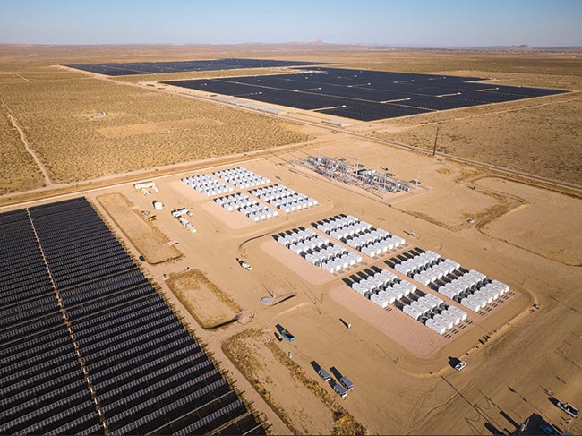
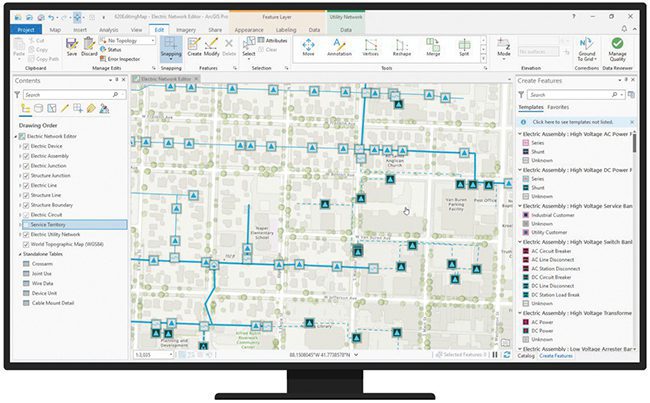
2. A new generation of location intelligence applications democratize this technology by putting actionable information and insights into the hands of people across every department of a power generation or other utility. Courtesy: Locana |
Another key factor driving the era of location intelligence is the availability of robust datasets and AI-driven processing power to turn data into information. The combination of location data from a utility’s own internal information technology (IT) assets with complementary open-source datasets from external providers is a powerful one-two punch that is serving as a catalyst for the new era. Utilities now have instant access to multi-faceted data that gives them a breadth of information related to every aspect of their operations. The availability of this data has been mirrored by major advancements in AI and cloud computing-based resources, able to analyze that data and extract the right insights at the right moment for the right department and employee (Figure 2).
The changing nature of the power generation workforce is another catalyst. Younger workers entering the sector have grown up with technology, and already use apps every day that utilize location data to provide features that would otherwise be impossible. Those employees are not only comfortable with location intelligence, they also fully expect it to be part of the technology they use in their day-to-day workflows. Utilities that embrace this technology will be able to take full advantage of the skillsets that these younger workers bring to the job.
Another catalyst for location intelligence is the urgency created by external factors that are placing tremendous pressure on utilities. Public safety issues such as massive wildfires are driving the urgency; so is the aggressive timeline of many utilities’ net-zero goals. Public demand for renewable energy is another major factor, as is industry consolidation. Each of those present operational problems that utilities are struggling to solve are much more solvable with a location intelligence strategy.
Decarbonization Targets
Net-zero initiatives are a great illustration of the impact of location intelligence. Utilities are setting ambitious net-zero goals with aggressive timelines for decarbonizing their operations. A recent study by S&P Global Market Intelligence reported that 70% of the largest electric and gas utilities have set targets equivalent to net zero, or have announced plans to comply with similarly aggressive state mandates. Several plan to reach their goals at least a few, and in some cases, several years ahead of their original schedules.
For utilities to successfully achieve these decarbonization goals, they need to effectively use geospatial technology and data across their organization. Many net-zero initiatives—including the deployment of renewable energy assets, infrastructure upgrades, vehicle fleet overhauls, the use of environmental Internet of Things (IoT) sensor networks, and much more—can only be achieved on aggressive timelines if utilities have an effective geospatial system that integrates across the organization. Planning, implementing, and measuring the benefits of those decarbonization efforts simply are not possible without analyzing location data from across the organization and delivering real-time actionable insights, whether from thermal or renewable generation.
To understand, operate, and optimize renewable energy assets in a network, utilities need to collect, analyze, and derive insights from location data on a massive scale. This is because the distributed nature of renewable energy assets makes many aspects of renewable programs extraordinarily complex, including load planning, predictive maintenance, asset tracking, smart grid design, outage response management, mobile team workflows, and more. Location intelligence, powered by location data collected from mobile devices and analyzed by powerful AI, provides the foundation for both the largest strategic decisions and smallest daily tasks related to renewable energy programs.
Location intelligence has become a reality at the right moment for the utility industry. This technology, largely hidden in the geospatial department for the past couple of decades, is ready for a much-larger role. Forward-looking utilities across the U.S. have already realized that and taken major steps into the location intelligence era.
An example is the work that Locana, a location and mapping technology company, has done with California utilities. Groups there are collaborating to use location intelligence to jointly monitor and assess wildfire risk, and conduct mitigation through preventative vegetation management. This effort combines location data from multiple sources, analyzes the data using sophisticated AI-driven analytics, and then uses those insights to guide the work of crews using mobile devices.
In the Midwest, a utility is using location intelligence as the foundation for risk mitigation initiatives for its natural gas distribution network and other infrastructure. The group is utilizing a combination of internal and external location datasets to create a more comprehensive and accurate view of risk to protect the public, and the utility’s investments in infrastructure.
An important step toward a robust strategy is to give internal and external location intelligence experts a seat at the table for any critical initiatives. These experts bring a perspective that can help solve problems that may seem unsolvable and intractable, but that can be addressed with the kinds of data and insights offered by location intelligence. It’s also an important step to break down artificial walls that stand in the way of broader sharing and use of location data across an organization, both now and in the future.
—Jaime Crawford is senior vice president of Strategic Markets for Locana (formerly Critigen), a location and mapping technology company whose software products and services solve infrastructure, sustainability, business, and social challenges.