Today, drones equipped with sensors and cameras are proving their worth in gathering real-time footage that can be stored for later analysis. Uncrewed aerial systems can detect failing structures and equipment in less time and for less cost than traditional methods.
In America and overseas, the built environment shows signs of strain. Major bridges have buckled, energy grid outages from severe weather are now common, and dams have failed. It’s the result of several factors: population growth, climate change, and worn-out infrastructure systems. The American Society of Civil Engineers estimates the U.S. alone needs $3.6 trillion in infrastructure investment by 2020 just to bring the country’s support systems to acceptable levels.
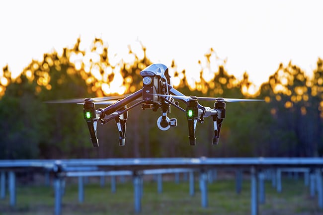
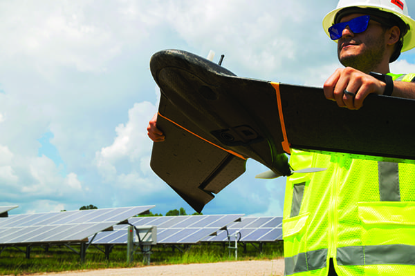
Drones play a growing role in helping locate problems in the systems people rely on for daily life and business (Figure 1). Uncrewed aerial systems (UASs) can detect failing structures and equipment in less time and for less cost than traditional methods. Usually, they’re safer, too.
 |
|
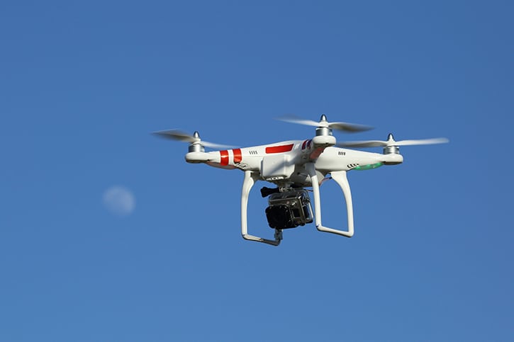
1. Drones come in various shapes and sizes. senseFly’s eBee X fixed-wing drone is shown here ready for launch. Courtesy: senseFly |
For example, topographical and geological data gathered by drones can generate models that help identify promising oil and gas (O&G) drill sites or the optimal layout for a solar utility array. High-resolution images collected from the air can reveal corrosion on transmission line conductors. Thermal sensors attached to drones hovering above pipelines can detect leaks and first-person, aerial-view video can scope structures after disasters when conditions on the ground are too risky for people.
New use cases will emerge as drone technology continues to develop. Today, drones equipped with sensors and cameras are proving their worth in gathering real-time footage that can be stored for later analysis, such as up-close videos, thermal imagery and terrain maps, and cloud points using light detection and ranging (LiDAR) technology and volumetrics. There are at least five inspection areas that are benefiting from drone technology: transportation, energy, renewable energy, water systems, and air quality.
Transportation Infrastructure
More than one-third of interstate bridges have been in service for more than 50 years. More than 55,000 bridges in the U.S. are now considered structurally deficient—spans that are crossed by vehicles 185 million times a day. The nation’s largest single infrastructure system—interstate highways—is past its design life.
Eighty percent of state highway departments now have UAS programs that are helping them keep an eye on infrastructure. They use drones for bridge, pavement, and light-pole inspections, and to gather aerial views of highway construction progress. Drones deliver much better data about what’s going on, without requiring inspectors to climb to heights, go up in a bucket truck, or be in proximity of speeding traffic. One study found drones could detect concrete crack sizes on bridges down to 0.02 inches, even in low-light conditions.
Railway infrastructure is also benefiting from drones. In one example, the time required to collect survey data on busy existing railroad tracks, needed as part of design work for a new line near London, was cut from an estimated three to six months to about two days, with photographs providing 1- to 2-millimeter accuracy levels.
Energy Infrastructure
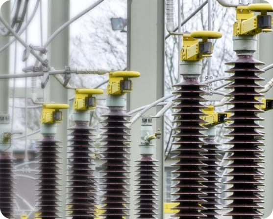
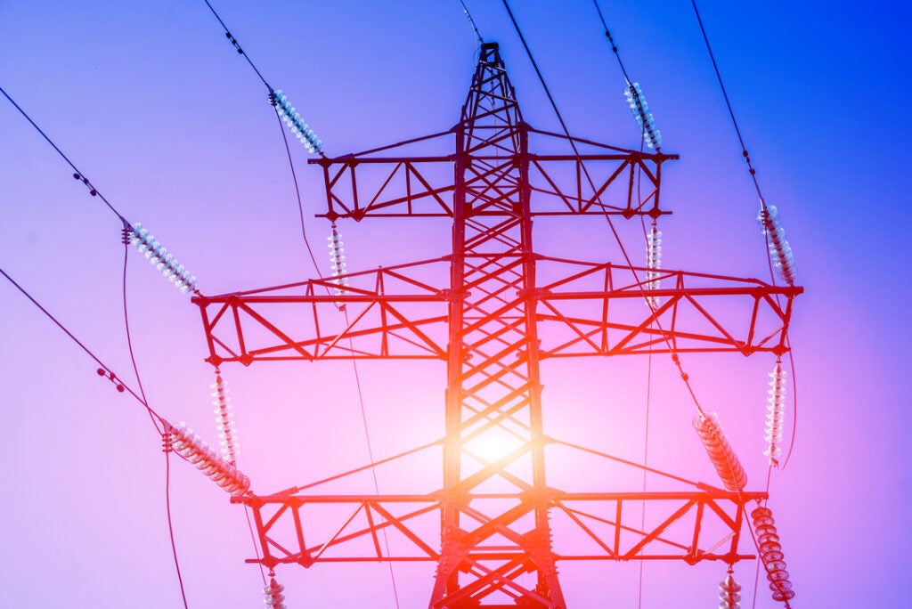
Some parts of the U.S. electric grid predate the turn of the 20th century, with most transmission and distribution (T&D) lines built in the 1950s and 1960s having a 50-year life expectancy. With more than 640,000 miles of high-voltage transmission lines, 5.5 million miles of distribution lines, and thousands of electric power generation facilities, it takes a lot of maintenance. And right as the need for higher maintenance is growing, transmission line workers as a group are aging, with baby boomers retiring and fewer line workers joining.
Further, America has more than 2.6 million miles of O&G pipelines, also susceptible to periodic failures. Utilities and O&G companies see UASs as part of the solution for surveilling these vast systems so that they’re kept in good working order, stay in regulatory compliance, and are more resilient. A few additional ways O&G enterprises are leveraging drone data include:
- ■ Underground pipeline leaks can be pinpointed by aerial photography that’s run through drone software to create high-resolution vegetation maps showing plant kill-off zones, a sign of leaks.
- ■ Utilities map service areas using LiDAR cloud points, then compare such maps after a storm moves through. They use change detection to determine damaged assets.
- ■ Drones mounted with infrared cameras can produce thermal imagery of pipeline routes; hotspots may point to potential defects in pipeline insulation or leaks invisible to the human eye.
- ■ Uncrewed aerial vehicles (UAVs) can zoom in for close-ups of equipment like flare stacks while they are running, instead of the traditional approach: shutting down the system while an inspector climbs the stack to examine it.
The list of energy infrastructure inspection uses for drones is long, and will keep expanding as BVLOS (beyond-visual-line-of-sight) flights become an accepted practice in the energy sector.
Renewable Energy Infrastructure
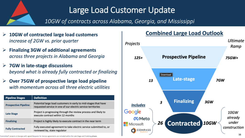
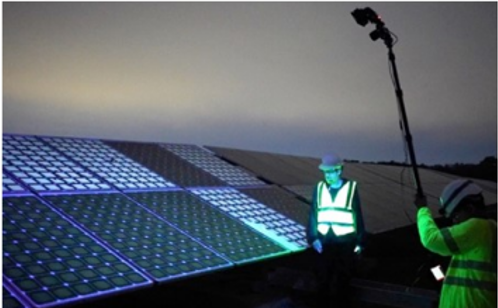
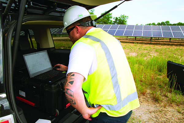
Solar farm developers using data from UASs have revolutionized how they site their farms. SunPower, a leader in global solar innovation, deploys drone fleets to capture geographic information used to create 3D models and maps. It integrates these into the company’s software for site planning and energy harvest estimates. Then, it crunches the data to determine which plant layout will generate the most megawatts, by factoring in the angles of the terrain and optimizing the positioning of panels (Figure 2).
 |
|
2. Data captured by drones is often downloaded to computer software that can perform a variety of analysis to help identify anomalies. Courtesy: senseFly |
Many of the nation’s 6,000-plus utility-scale solar facilities use UASs for inspecting solar arrays. Drones can detect specific panels that have gone offline or are underperforming by just flying over with a thermal sensor (see sidebar).
|
Optimal Solar Efficiencies: Saving $168,243 with Drones In search of a way to enhance the efficiency of its solar farm, a leading provider of utility- and community-scale solar power turned to senseFly’s drone technology to increase productivity and unlock financial savings. A 161-acre farm needed to be surveyed in order to locate and identify any anomalies across its photovoltaic panels that could compromise the farm’s efficiency. As inspecting the area manually would have been heavily time consuming and labor intensive, the team turned to senseFly, the global leader in fixed-wing drones, to support them in locating panel issues. Thanks to its unparalleled ease of use and streamlined data collection, senseFly’s Solar 360 solution was selected, a uniquely efficient thermal drone solution that enables the automatic assessment of solar plant performance at a sub-module level. By combining senseFly’s eBee X fixed-wing drone with its Duet T Sensor (Figure 3) and Raptor Maps software, the fast and fully automated senseFly Solar 360 solution could be easily integrated into the provider’s workflows without requiring either drone piloting skills or the manual analysis of aerial solar farm data.
Furthermore, because the eBee X can fly for up to 70 minutes when carrying the senseFly Duet T thermal/RGB mapping camera, it allowed the 161-acre site to be documented in a single 42-meter (138-ft) flight while the minimal image requirements of the Raptor Maps software sped up the inspection to be at least five times faster than competing software. The radiometric thermal and visual RGB imagery captured during the single flight was analysed by Raptor Maps to identify, classify, and localize anomalies automatically. In a matter of hours, a detailed, actionable inspection report identifying 312 anomalies, including issues with cells, diodes, modules, and strings, was produced. The result of using senseFly’s Solar 360 solution generated an estimated annual saving of $168,243 and a six-fold return on investment due to the significantly reduced time on-site and the associated labor costs. Further cost benefits were delivered by the RGB camera data, which generated a geo-accurate digital terrain model that can be used to optimize the farm’s design in the future. By integrating the senseFly Solar 360 solution into its site inspections, the energy provider was able to harness the benefits of uncrewed aerial vehicle (UAV) technology without the need of a licensed pilot or having someone capable of processing the results in-house. With its efficient solar farm inspection, easy data collection, and automatic processing, the senseFly Solar 360 solution enabled the surveillance of a large solar farm and subsequent discovery of sub-module anomalies that required maintenance in a single day. The success of this project illustrates the value integrated UAV solutions play in the future of solar farm design, planning, and maintenance, and their potential to optimize efficiencies across operations. —Troy Hittle is general manager, North America, with senseFly. |

There are also more than 270,000 wind turbines operating globally, making for an estimated 800,000-plus turbine blades worldwide that are battered by the elements and need regular inspections for wear. Drones provide close-up images of this equipment so field workers can remain safely on the ground.
Water Systems
UAVs were a critically important tool during a 2017 scare at the 50-plus-year-old Oroville Dam. Aerial views helped California Department of Water Resources officials see what was going on in real time and guide responses, including evacuation orders and repairs.
Many of the nation’s 90,000-plus state, federal, and privately owned dams are reaching the end of their useful lives. Plus, dams, aqueducts, hydroelectric equipment, fish ladders, reservoirs, culverts, canal locks, and treatment plants also require frequent inspection.
Infrared sensors on drones are in use for leak detection, and while ground-penetrating radar for this purpose is at an early stage, results are promising. Water system managers are also finding UASs beneficial for vegetation management, equipment maintenance, security, environmental monitoring, and documentation during dam replacements and construction management.
Air Quality
Colorado’s largest O&G producer, Anadarko Petroleum, also uses drones equipped with infrared devices to survey sites with air pollution that could exceed limits. Once a leak is detected, ground crews are sent to tend to the site.
Earlier this year, Bangkok’s air pollution levels reached dangerous new heights. To help reduce pollution, officials used a fleet of drones to spray water and non-hazardous chemicals into the air. Though more testing is needed, results of a small test showed that the drones helped reduce dust particles in the air by roughly 10 micrograms per cubic meter.
Similarly, following high ozone pollution readings in Wyoming, the state launched a series of ozone strategies in an attempt to meet federal air-quality standards, including installing a liquid-gathering pipeline system to reduce vehicle traffic and converting pumps to run on solar energy. Jonah Energy, one of the largest privately held natural gas producers in the U.S., is turning to on-site and drone-mounted emission detection sensors. Wyoming Department of Environmental Quality documents report that the company’s use of drones has resulted in thousands of tons of volatile organic compounds and nitrogen oxides being offset and reduced.
In addition, a recent report by Nature Communications suggests that if carefully deployed, drones can be used for delivery to help reduce greenhouse gas (GHG) emissions and energy use in the freight sector. Truck transport accounts for 24% of transportation-related GHG emissions and comprises 23% of transportation energy in the U.S.
UAVs are also proving to be valuable tools for delivering supplies to areas with poor road networks, such as villages in rural Africa. The report explores how, in most cases, life-cycle GHG emissions and energy use of package delivery by small drones are lower than ground-based delivery, taking factors such as size and speed into consideration.
More Advances on the Horizon
UAV remote-sensing and inspection technologies are rapidly evolving. As artificial intelligence goes mainstream, predictive maintenance will become standard operating procedure, making it possible to head off equipment failures. Connected drones will soon make their debut in a 5G world, bringing more capabilities and data within reach.
So, how is the right data obtained from a drone infrastructure inspection program? By asking the right questions. The following are some of the most important queries for framing initial conversations:
- ■ What area of operations present the biggest potential gains for cutting costs?
- ■ Once data is gathered, how will it be analyzed to develop possible corrective actions? What integrations do in-house systems need? A utility with natural gas pipelines may need drone software to integrate with secure systems that show pipeline locations.
- ■ How will baseline data on traditional infrastructure inspection costs and safety be compared with that achieved using UASs? Having digital logging of flight hours, pilot rosters, training certifications, authorizations, aircraft, and projects in one place is invaluable. These logs provide insights on return on investment (ROI), transparency, and a record for legal teams, which are important quality-control aspects of any aviation program.
- ■ Should programs be built in-house or outsourced? Organizations using UASs take several different approaches to data collection and analysis. According to a 2018 survey about the state of drones in big business, almost two-thirds of large enterprises said their companies don’t outsource any aspect of their drone programs. Those companies handle their own flights, data processing, and data analysis, as opposed to the companies that choose to outsource.
- ■ If an in-house program is selected, what preliminary steps should be taken?
UAS programs have been implemented by many progressive businesses, and for most, the paybacks are substantial. ■
—Steven Perez is manager of Client Strategy at Skyward, a Verizon company.