satellite
-
 Engineering
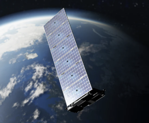
Revolutionizing Energy Connectivity: The Strategic Role of LEO Satellite Networks
By positioning satellites significantly closer to Earth, LEO networks deliver high-bandwidth, low-latency connectivity that makes connection speed at an offshore platform or remote location, just as fast and secure as you will find at corporate headquarters.
-
 T&D
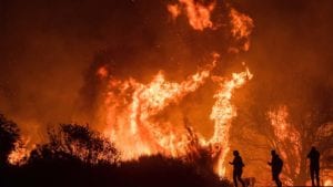
T&DHow PG&E Is Reducing Wildfire Risks Using Satellite Imagery
Wildfires have had a devastating impact on California and on the state’s largest utility company, Pacific Gas and Electric (PG&E). PG&E’s equipment has been linked to several major wildfires in the past including the 2018 Camp Fire (the deadliest wildfire in California history, killing 85 people, according to CAL FIRE, the state agency responsible for, […]
-
 Power
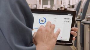
PowerHow Satellite Connectivity Can Improve Visibility and Communication Throughout the Energy Sector
Amid an industry-wide labor shortage and global supply chain disruptions, the energy sector is under immense pressure to increase production. These issues, in addition to geopolitical tensions, are deeply complex and cannot be addressed on an individual scale. In addition, the energy industry faces major challenges pertaining to communication given that the workforce and equipment […]
-
 Solar
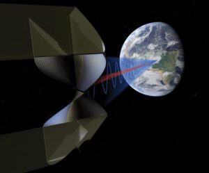
SolarSpace-Based Solar Power May Be Closer Than You Think
The vision sounds far-fetched: If a kilometer-scale satellite could be outfitted with a hybrid array of photovoltaic (PV) and concentrating solar power (CSP) panels and launched into orbit 22,400 miles above
-
 Research and Development
A Satellite View of Hurricane Michael’s Power Outages
After Hurricane Michael made landfall near Mexico Beach, Florida, as a category 4 storm on October 10, it moved across Georgia, South Carolina, North Carolina, and southeastern Virginia on October 11, and finally out into the Atlantic on October 12. According to the U.S. Department of Energy’s Infrastructure Security and Energy Restoration office, the storm […]